A Bit of Gray on an Emerald Isle
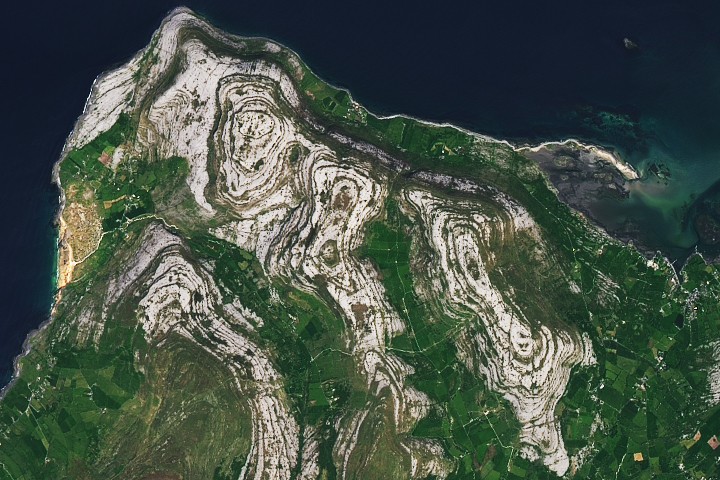
Though Ireland is known for the many shades of green that grace its grassy pastoral landscapes, there's one corner of the Emerald Isle where gray reigns supreme. In the Burren region, on the island's west coast, what geologists describe as limestone pavement covers much of the rocky, treeless landscape.
The OLI (Operational Land Imager) on Landsat 8 captured this view of the Burren on May 16, 2025.
These folds in the tilted rock layers and differences in their rate of erosion produced the terraced appearance that defines the Burren's hills, with more erosion-resistant layers of rock persisting as ledges. Glacial activity also played a role in sculpting the landscape, scraping away soil and sediment to expose the limestone pavement and smoothing the region's hills.