← Back to News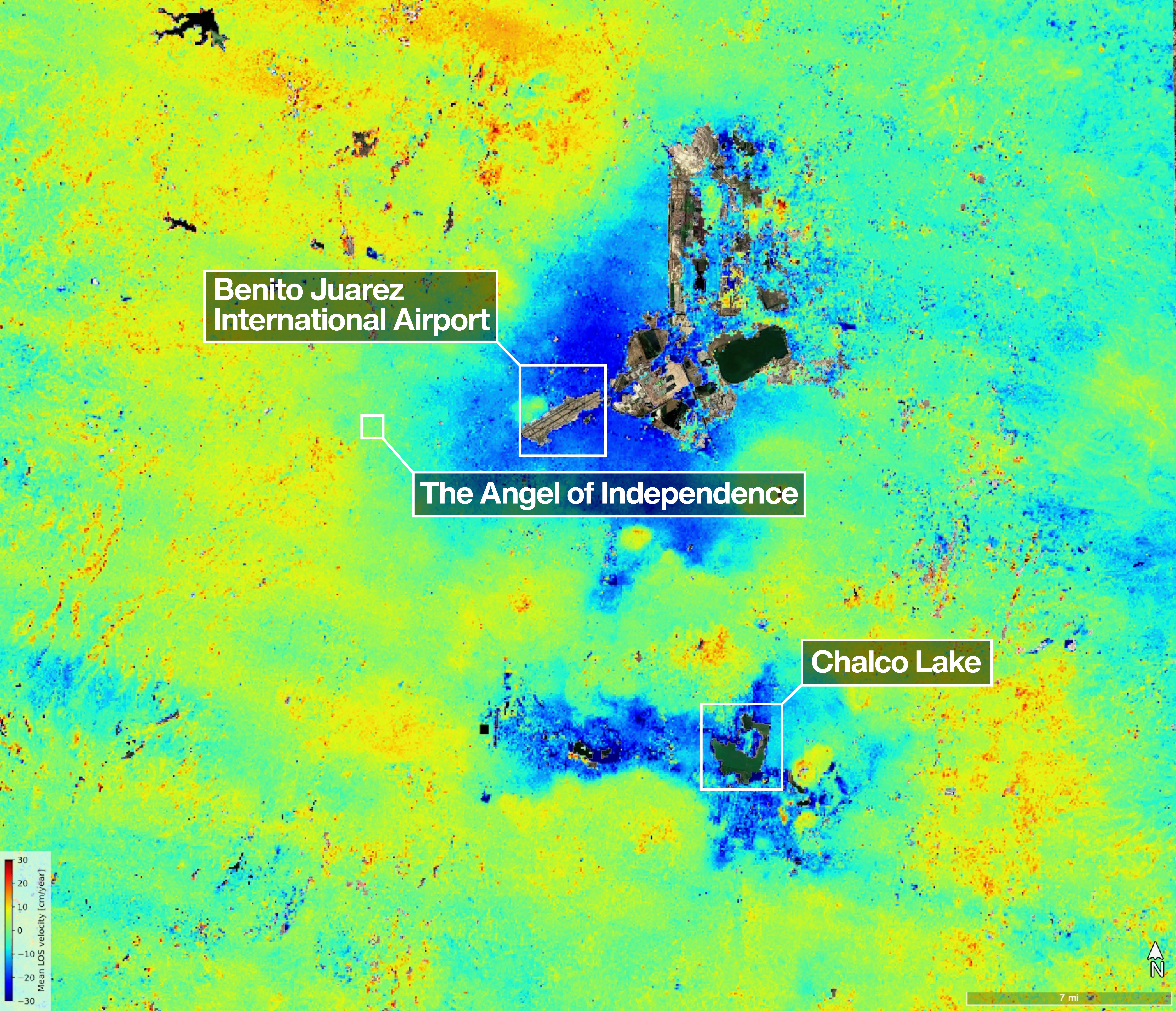
Image source: NASA
Milestone
US-Indian Space Mission Maps Extreme Subsidence in Mexico City
References
Story Brief
The NISAR satellite pinpointed areas of the city that are sinking by more than half an inch per month due in large part to groundwater pumping.
New data from NISAR shows where Mexico City and its environs subsided by up to a few centimeters per month (shown in blue) between Oct.
Uneven and seemingly small elevation changes have added up over the decades, fracturing roads, buildings, and water lines.
Reference Details
Keep Reading
Mentioned Companies & Entities